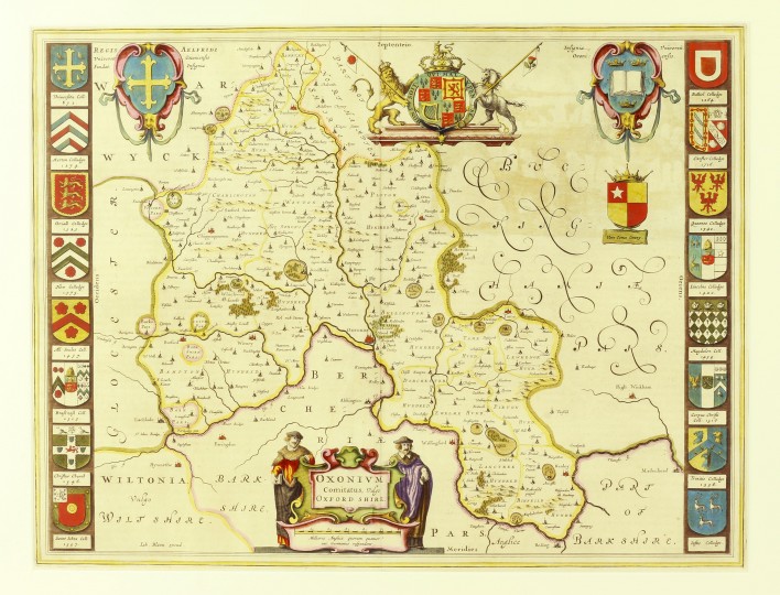
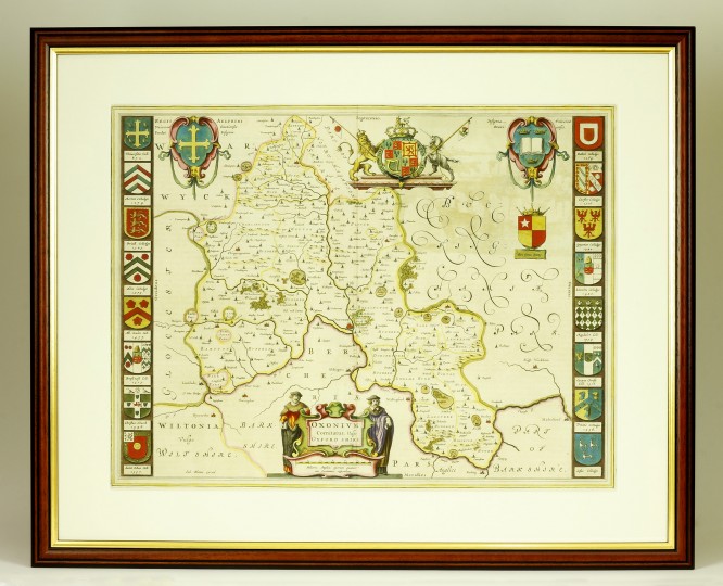
Comitatus, Vulgo Oxfordshire


Oxonium Comitatus, Vulgo Oxfordshire
1647.
385mm x 505mm. A fine, engraved, hand-coloured map of Oxfordshire by one of the most famous cartographers of the period. Details include hills and parks as well as towns and villages. Royal coat of arms at head, embellished in gilt. Oxford college crests to borders and decorative cartouche at the foot of the map. Central crease where folded, some offsetting to upper corner, but a crisp, bright example of this important map.
The Blaeu family were seventeenth century publishers of maps, globes and atlases. Their Amsterdam premises were destroyed by fire in 1672, losing all of their plates, prints and stock and effectively ruining the firm.
LITERATURE: BLAEU, Johannes Theatrum Orbis Terrarum (1647)
Stock ID: 36580
Sold
We have sold this item, but similar items
may become available in the future