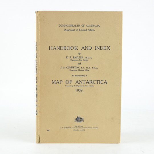
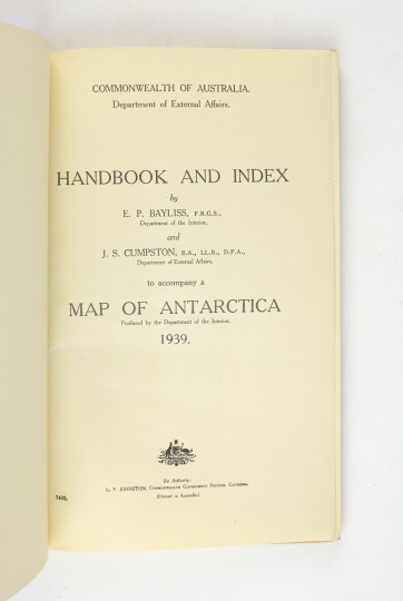
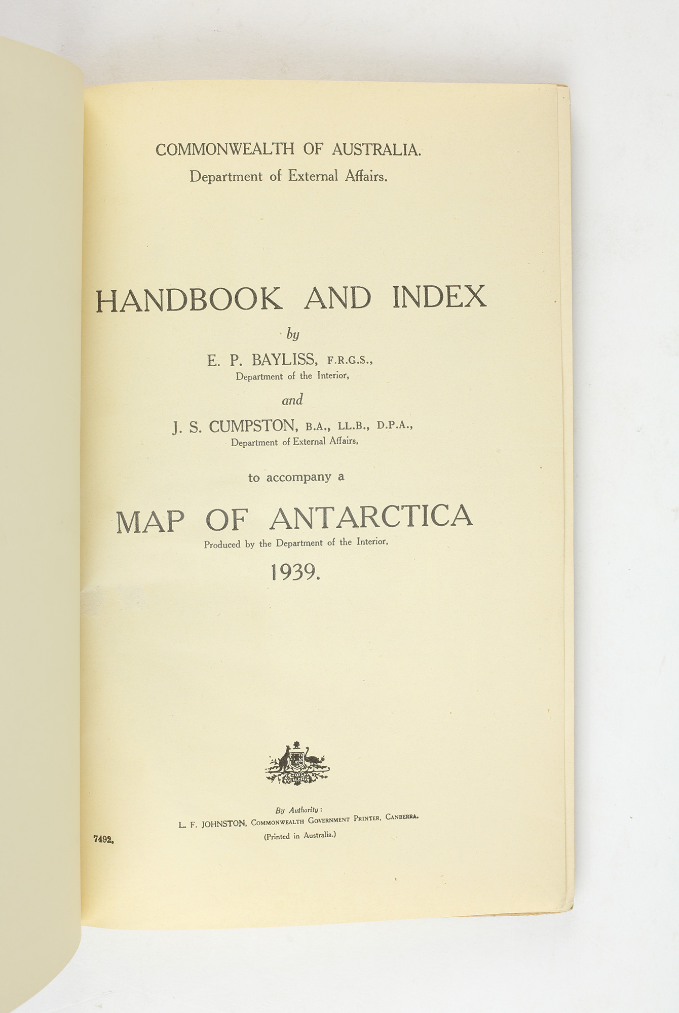
With the accompanying Handbook And Index by Bayliss and Cumpston.
A MASTERPIECE OF INFORMATION GATHERING
Map of Antarctica With the accompanying Handbook And Index by Bayliss and Cumpston.
Produced By The Property & Survey Branch, Department Of The Interior, 1939.
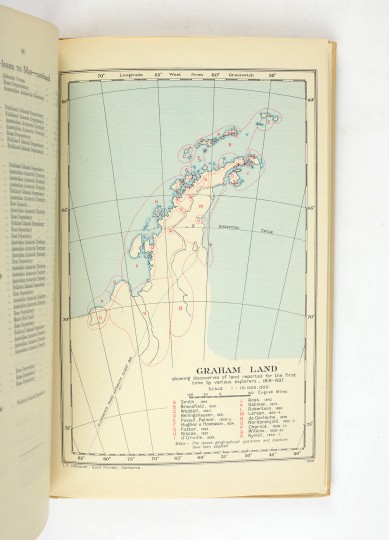
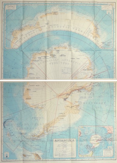
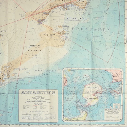
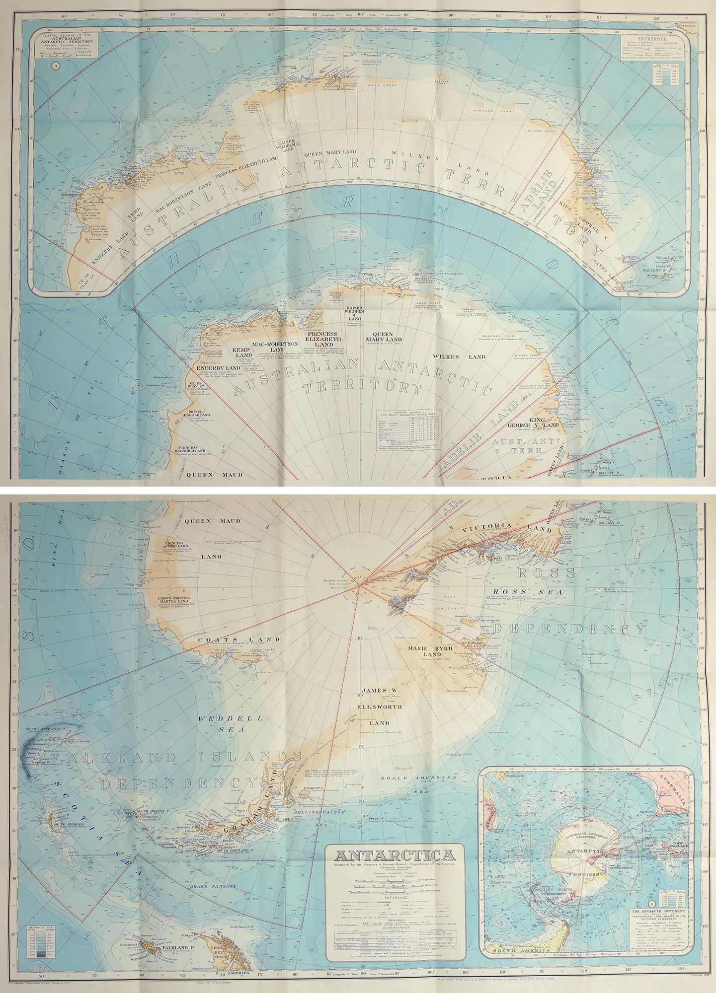
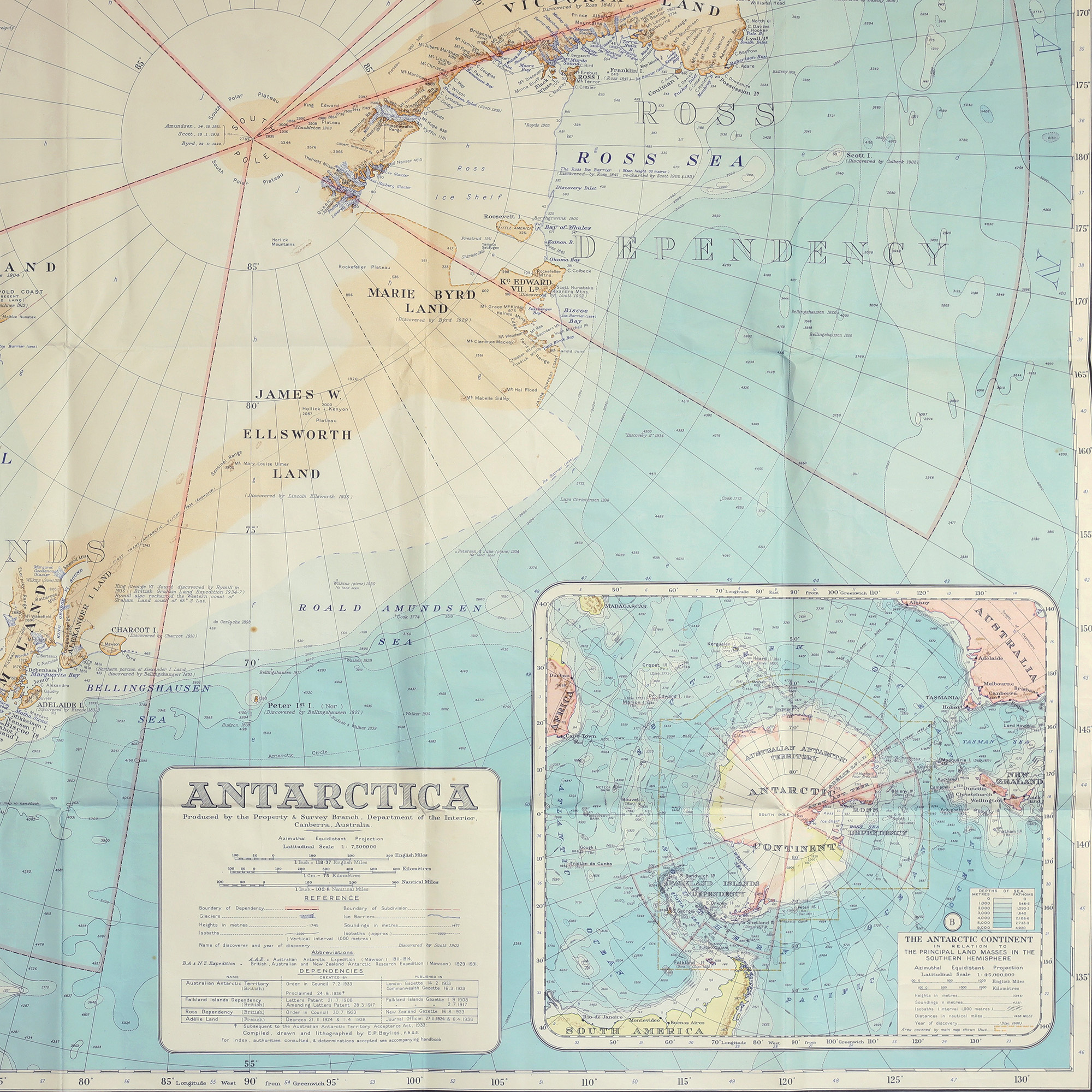
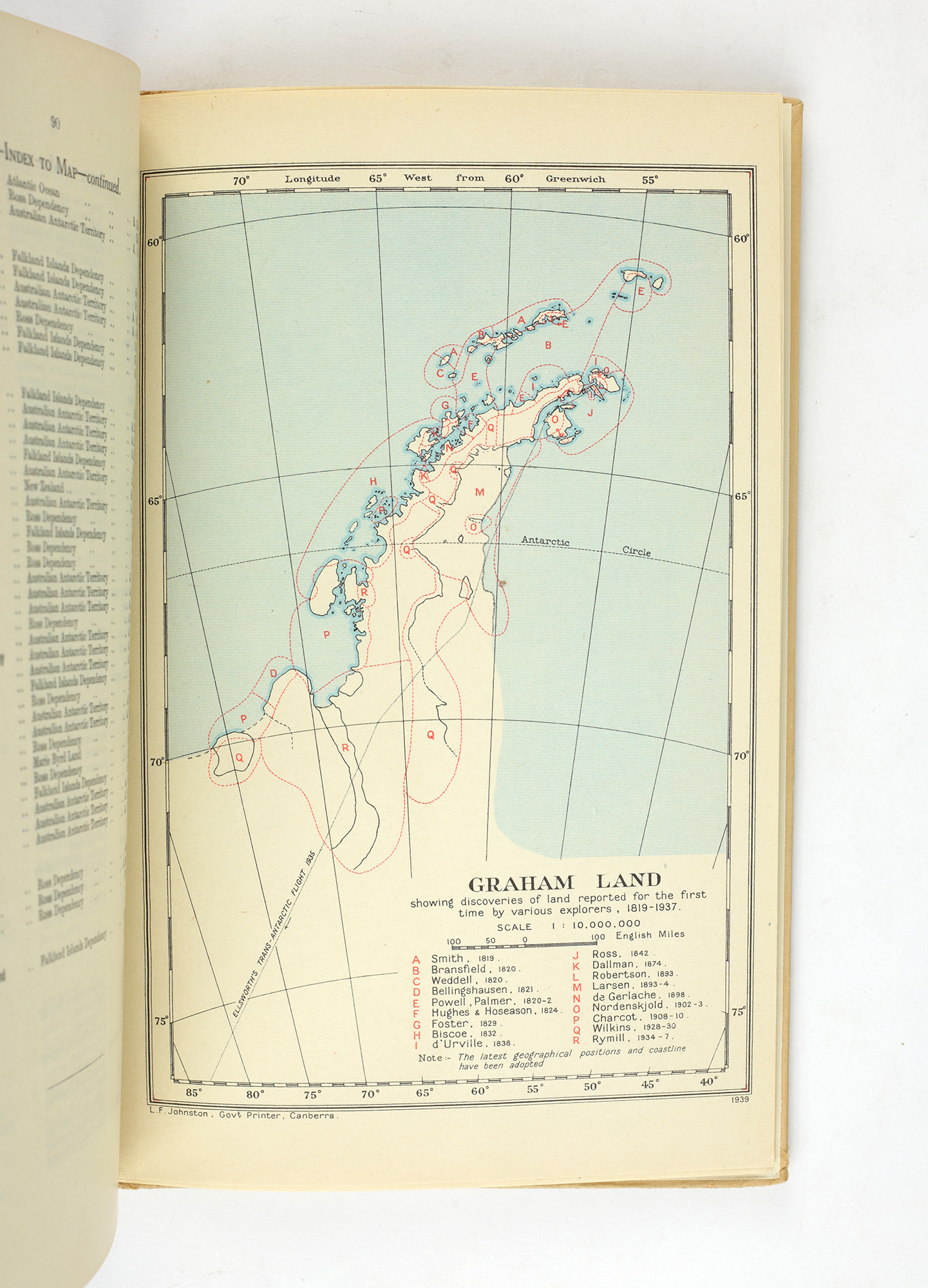
First edition, large issue at 1:7,500,000. Two sheets, printed in eight colours, each 1010 x 740mm and backed with linen. Two inset maps, one of The Australian Antarctic Territory, and one wider view of the Antarctic continent in relation to Australia, New Zealand and South America. A further individual map of Graham Land features in the Handbook. A fine example, a little creasing around the folds, but nevertheless most attractive with the map remaining bright and free from foxing. The handbook in near fine condition.
An excellent and rare example of this landmark map of the Antarctic, in the preferred large format and with the original handbook.
Hitherto, due to the reliance solely on expedition reports from the Heroic era of Antarctic exploration, no adequate map of the Antarctic had been produced, and certainly no map existed that could record Australia's claim to 40% of the continent.
Commenting of the cartographic situation in 1935, Lars Christensen wrote:
"I have in front of me an ordinary map of the South Polar Regions, published in 1926 by an English firm. It illustrates our common impression as to the land and sea in those far-off regions. In this map between Coats Land at 20OW and Kaiser Wilhelm Land at 90OE - a distance of thousands of kilometers - there is nothing but a little black mark at 50E, called Enderby Land, and a little further down, a dotted and tentative line, called Kemp Land. That is all."
This is the cartographic deficit the Australian government sought to address, and following the introduction of aviation to Antarctic exploration, more comprehensive charting of the continent seemed possible. And so, through the study of around 250 independent sources, chief cartographer Edward Bayliss worked to update previous attempts and gather information for inclusion in the present map.
The resulting map, according to John Manning, author of Mapping Antarctica, "is a masterpiece of information gathering and careful presentation... it is a fine record of the knowledge gleamed from early explorers' reports and 75 years later it contains no glaring errors, as other contemporary maps contain". 2,000 copies were printed and offered in two issues - a single sheet at 1:10,000,000 for 5 shillings, and the present two sheet issue at 1:7,500,000 for 7 shillings and sixpence.
Examples of the map in commerce are incredibly uncommon. While a Handbook appeared in the Renard sale of 1994, the map was "not here present, and seldom encountered". An example of the smaller, single-sheet issue is recorded in the Taurus collection. In addition to the present example, only one other copy of the large issue is recorded in commerce in the intervening period.
PROVENANCE: 2nd Lieutenant G. B. N. Creswick, original purchaser, with the letter confirming his purchase from Australia's Department Of External Affairs loosely laid in.
Stock ID: 39810
Sold
We have sold this item, but similar items
may become available in the future