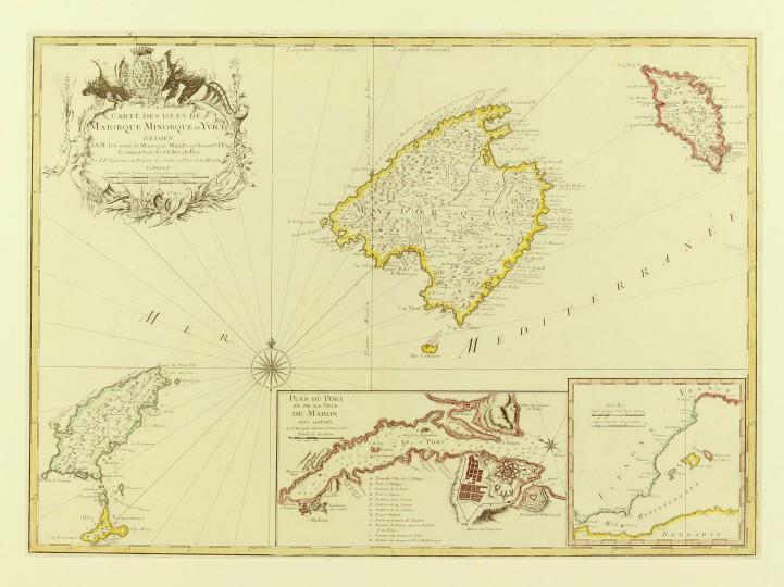
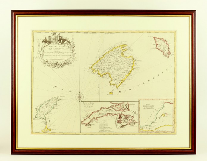
Balearic Island Map, Mallorca, Menorca and Ibiza
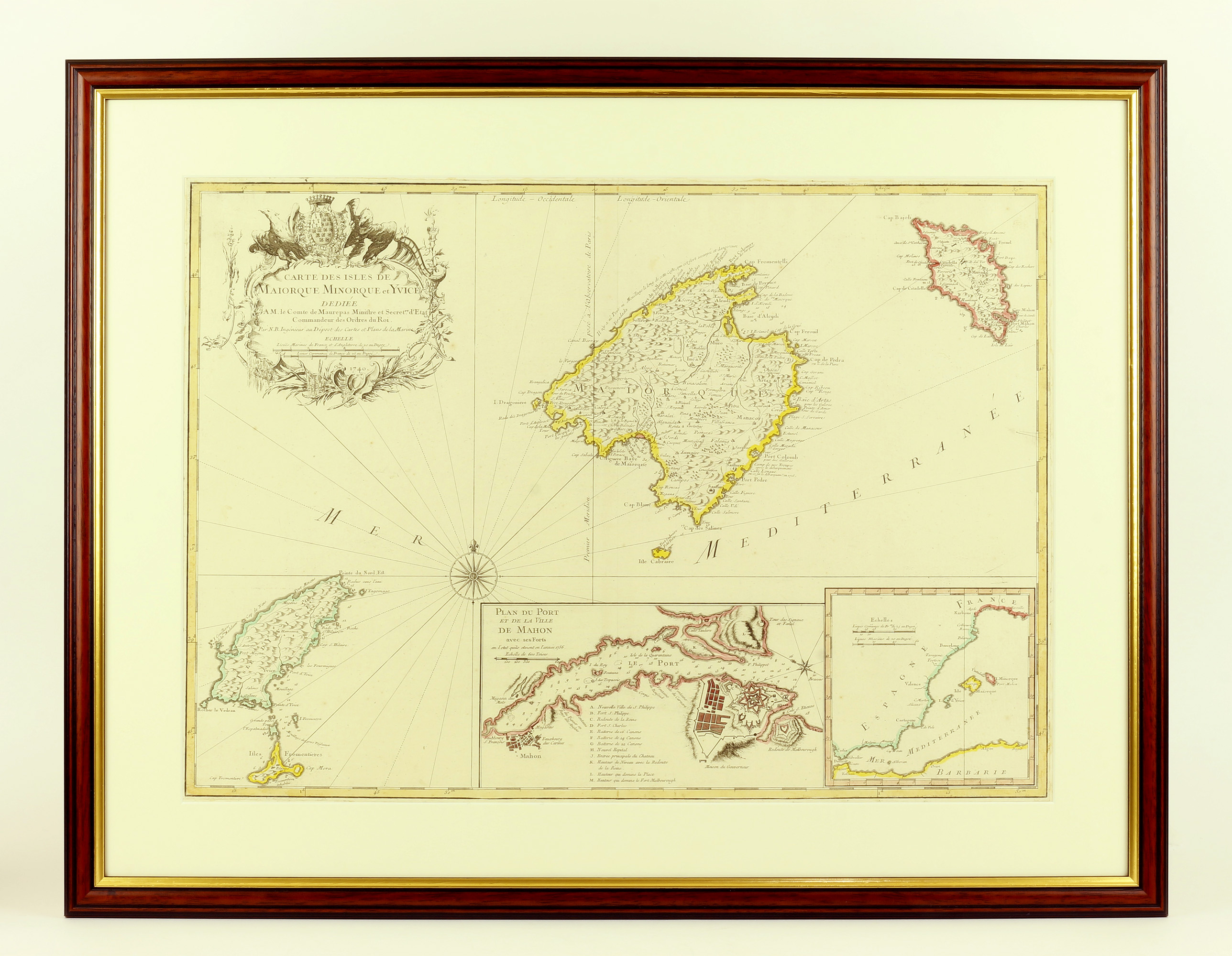
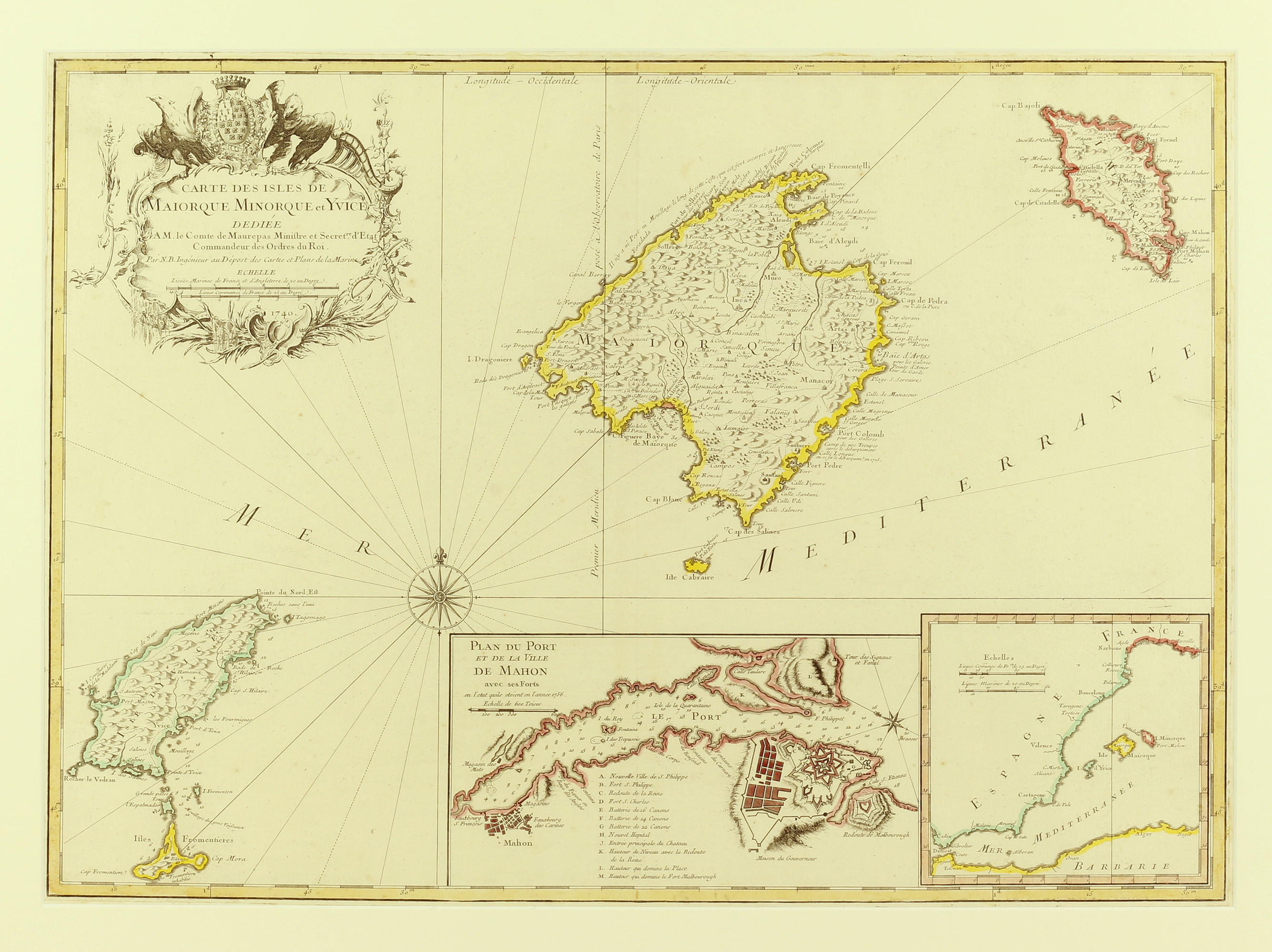
Carte Des Isles Maiorque Minorque Et Yvice Balearic Island Map, Mallorca, Menorca and Ibiza
Dépôt de la Marine, 1756.
420mm x 580mm. Original hand-coloured copper engraved map. Large decorated cartouche to the top left, and two inset maps to the bottom right, one a plan of the port and battlements at Mahon, the other of the Western Mediterranean as a whole. A fine copy, with the central crease as usual.
Jacques-Nicolas Bellin was a French hydrographic engineer who first joined the Dépôt de la Marine, the institution founded in 1720 to draw and amend the maps used by the navy, at the age of eighteen. He first drew the map from which this copy is engraved in 1740, shortly after his promotion to Ingenieur Hydrographe de la Marine, a promotion which gave him the monopoly in the printing and trade of navy maps.
This plan with the Port of Mahon correctly orientated is likely to be drawn after the capture of Minorca by the French navy following the Siege of Fort S. Phillipe (depicted on the South bank of the plan).
The map of the Balearics as a whole was one of only twenty-six maps Bellin had bound up and sent to the Royal Society of London in 1752, as part of his candidacy file for election to the scientific society.
Pastoureau (1993)
Stock ID: 36599
Sold
We have sold this item, but similar items
may become available in the future